A Comprehensive Review of Scholarly Debate (1922-2026)
Jonas Bergman | March 17, 2026

This paper examines the century-long scholarly debate surrounding the location of the ancient Baetis River's two mouths and the island and city of Tartessos described in ancient sources. Beginning with Adolf Schulten's foundational work in 1922, through the critical geological interventions of Juan Gavala in 1959, the paradigm shifts of the 1968 Jerez Symposium, and culminating in the 2024 reconciliation of archaeological and textual evidence, this debate illustrates the tension between philological interpretation and geoarchaeological science.
The question of where the ancient Baetis River (modern Guadalquivir) met the sea—and whether it possessed "two mouths" with an island between them—begins not with modern scholarship, but with the ancient sources themselves. Understanding what Strabo, Avienus, Pliny, Plato, and other classical authors wrote is essential to grasping why this debate has persisted for over a century.
The geographer Strabo (c. 64 BCE – 24 CE), in his Geography Book III, provides one of the most detailed ancient descriptions of the region. Strabo describes Tartessos as a city and region located at the mouth of a great river, explicitly mentioning that the Baetis (which he calls by its Greek name or describes as the "great river") had two mouths as it entered the sea. The city of Tartessos, according to Strabo, was situated between these two river arms, effectively on an island or peninsula formed by the river's distributary channels. This description is crucial because it establishes the fundamental geographic claim that modern scholars have sought to verify: that the ancient Baetis had two distinct outlets to the sea, with a city located between them.
Strabo's text is particularly valuable because he was writing relatively close in time to the period in question (first century BCE), and his Geography was based on earlier sources as well as his own observations. As Schulten noted in his 1922 work Tartessos, Strabo's testimony formed the foundation for all subsequent attempts to locate the city (Schulten, 1922).
The Roman poet Rufius Festus Avienus, writing in the fourth century CE, composed the Ora Maritima ("Coastal Sea"), a poetic description of the coasts of the Mediterranean and Atlantic. Avienus drew heavily on earlier periplographic traditions—accounts of coastal voyages that dated back to the Archaic and Classical periods—and his work preserves information about Tartessos and the Baetis river that derives ultimately from much older sources.
In the Ora Maritima, Avienus provides one of the most detailed ancient descriptions of the river's multiple mouths. The critical passage (translated by Murphy, 1977, p. 21) reads:
"sed insulam Tartessus amnis ex Ligustino lacu per aperta fusus undique adlapsu ligat. Neque iste tractu simplici provolvitur unusve sulcat subiacentem caespitem, tria ora quippe parte eoi luminis infert in agros, ore bis gemino quoque meridiana civitatis adluit."
Translation:
"But the Tartessus river, spread through open spaces from the Ligustine lake, binds an island on all sides with its lapping. Nor does the river flow through with a simple course or singly cleave the underlying earth. Rather, on the eastern side, it brings three mouths into the fields, and it washes the south part of the city with four mouths."
This is the exact expression of "twice twin mouths" (bis gemino)—meaning four mouths in total: three on the eastern side and four on the southern (meridiana) side. This matches Strabo's description of "two mouths" while adding important detail about the complexity of the distributary channel system. The significance of Avienus for modern scholarship has been both celebrated and contested—celebrated because his poem preserves otherwise unknown geographic details like this, contested because the transmission chain of his information is complex and his own compositional date (fourth century CE) is far removed from the archaic period he describes.
As modern scholars have noted, Avienus's reliability varies, and his information must be evaluated carefully (Schmitt, 1978; De Hoz, 1989). However, the core geographic description—multiple mouths, a city between them—appears consistently across multiple sources, suggesting a kernel of geographic truth.
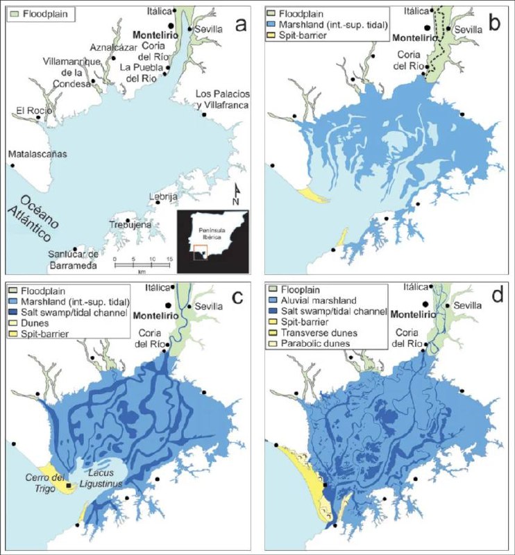
Gaius Pliny Secundus (Pliny the Elder), in his Naturalis Historia (Natural History, 77-79 CE), also provides information about the geography of southern Iberia. While less specific than Strabo or Avienus about the "two mouths" configuration, Pliny's encyclopedia preserves various place names and geographic details that illuminate the ancient understanding of the region. Pliny mentions the Lacus Ligustinus (the "Ligustine Lake"), which later geoarchaeological research has identified as the ancient name for the vast lagoon system that occupied the lower Guadalquivir valley.
Pomponius Mela (c. 43-45 CE), in his De Chorographia (On the Description of the World), Book 3, section 5, provides a particularly clear description that confirms both Strabo and Avienus:
"The Baetis [Guadalquivir] River, coming from the Tarraconensis region more or less through the middle of this one, runs down for a long time in a single stream, just as it originates. Later on, after it has made a large lake not far from the sea, a twin rises up as if from a new source, and the river flows on in separate beds as sized as it had arrived in its single bed."
This description of the river forming "a large lake" (a reference to the Lacus Ligustinus) before splitting into twin channels ("a twin rises up") precisely corroborates the accounts of both Strabo and Avienus. Mela's testimony is particularly valuable because he was writing in the mid-first century CE—closer to the Roman period than Avienus—and his geographic treatise was intended as a practical guide, not poetic embellishment.
Pausanias (c. 150-175 CE), in his Description of Greece (Periegesis tes Hellados), Book 6, chapter 19, section 3, explicitly states:
"They say that Tartessus is a river in the land of the Iberians, running down into the sea by two mouths, and that between these two mouths lies a city of the same name."
This is one of the clearest ancient statements on the geography of Tartessos—confirming the twin-mouth configuration and the city's position between them.
Perhaps the most famous ancient reference to a city "opposite Gadeira" (Cádiz) comes from Plato (c. 427-347 BCE), who in his dialogues Timaeus and Critias describes the legendary Atlantic island and city that existed, according to his account, before sinking beneath the sea. Plato places this city "opposite Gadeira" (Gádiz), describing it as situated on an island or coastal plain that was later overwhelmed by the ocean. While Plato's account is mythological rather than geographical in the strict sense, it establishes a tradition—continued by later writers—that connected the far west of Iberia with catastrophic flooding and lost civilizations.
Plato's description of a navigable river channel (or channels) reaching toward the city before emptying into the sea has been interpreted by some scholars as potentially reflecting memory of the Baetis estuary system, though this remains contested. In Critias, Plato describes the great circular ditch (the city's canal system) receiving streams from the mountains and coming towards the city "on this side and on that where it was let off into the sea"—again, like Tartessos (also located opposite Gadeira/Cádiz), having a stream on both sides of the city before emptying into the sea. The parallel is striking: both Tartessos and the Atlantean city are described as having waterways on either side of the city before reaching the ocean.
Taken together, the ancient sources present a consistent picture: a great river (the Baetis/Guadalquivir) that reached the sea through two distinct channels, with a city (Tartessos) located between them or on an island formed by the river's arms. This city was famous in antiquity—mentioned by Herodotus, Strabo, Avienus, and others—and its location became a subject of geographic inquiry already in the ancient world. The key questions for modern scholarship have been: Where exactly was this city? What happened to the "two mouths"? And why has the geography changed so dramatically since antiquity?
It is against this backdrop of ancient testimony—testimony that has been both trusted and doubted, verified and rejected—that the modern scholarly debate, beginning with Schulten, must be understood.
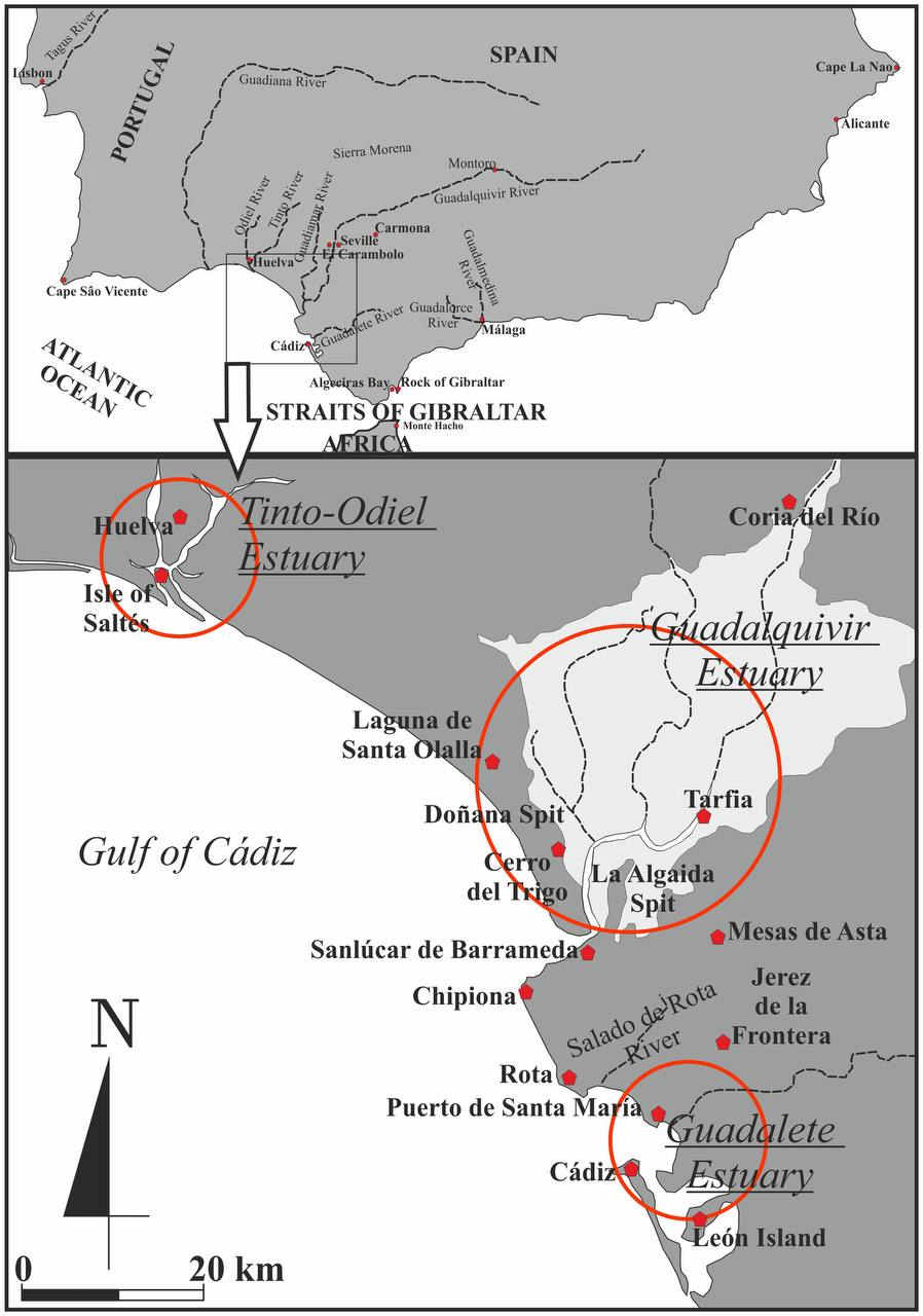
Adolf Schulten's 1922 work Tartessos established the modern scholarly framework for understanding the region (Schulten, 1922). Working with British archaeologist George E. Bonsor, Schulten conducted excavations at Cerro del Trigo near Almonte (in what is now Doñana National Park) between 1920 and 1925, seeking the lost city of Tartessos.
The methodology employed by Schulten and Bonsor was groundbreaking for its time. They worked with cartographer A. Lammerer and geologist O. Jessen to systematically explore the Doñana area. The excavations at Cerro del Trigo represented one of the first attempts to apply scientific archaeological methods to the search for Tartessos. The excavations took place in three phases: summer 1920 (initial exploration), August 1921 (first official excavation permit), and 1923-1925 (main excavation campaign).
However, their excavations at Cerro del Trigo found no Tartessian remains below Roman structures—the hypothesis was archaeologically falsified (Bonsor, 1928). This negative result proved pivotal, prompting scholars to reconsider the relationship between textual sources and archaeological evidence.
Spanish geologist Juan Gavala y Laborde's 1959 study of Guadalquivir geology fundamentally changed the entire parameters of the debate. Gavala demonstrated through extensive geological fieldwork and analysis that the Guadalquivir paleo-estuary was radically different in ancient times (Gavala y Laborde, 1959). His crucial insight was that a massive body of marine water—what he termed the "Gulf of Tartessos" (Sinus Tartessius)—existed in the first millennium BCE, extending far inland beyond its current position.
Gavala's work was revolutionary because it provided a geological explanation for why the Cerro del Trigo excavations had failed. The ancient coastline was far different from what Schulten had assumed when choosing that excavation site. The entire Doñana area, which had seemed a promising location based on textual sources, had been underwater or marshland in antiquity. This meant that any city located "at the river's mouth" in the first millennium BCE would have been in a completely different geographic position.
Perhaps most significantly, Gavala's work demonstrated that many of the proposed locations—including some that would resurface in later debates—were geologically impossible given the scale of the ancient estuary (Gavala y Laborde, 1959).
Proposed by: Adolf Schulten (1870-1960) and George E. Bonsor (1855-1930) | 1920-1928
Schulten and Bonsor proposed that the ancient city of Tartessos was located at Cerro del Trigo, near the modern town of Almonte in Doñana National Park. This location was chosen based on proximity to the modern Guadalquivir estuary and interpretation of ancient texts.
The excavations (1923-1925) found NO Tartessian remains below Roman levels—the hypothesis was archaeologically falsified (Bonsor, 1928).
Proposed by: Various scholars | 1920s-present
This represents a cluster of related proposals, all centering on the general area of modern Doñana National Park and the marshes between Seville and the Atlantic coast. After Gavala (1959), shown to have been open water/marsh in antiquity.
Proposed by: Chocomeli (1940), Martín de la Torre (1940) | 1940s-present
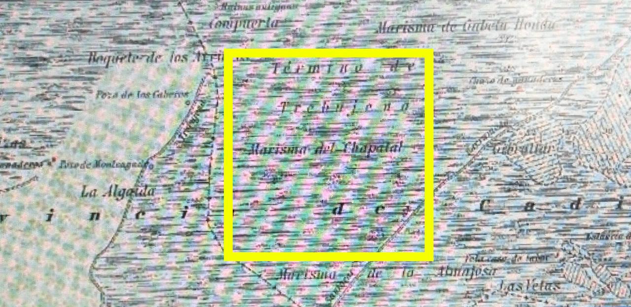
Proposed that Asta Regia (Mesas de Asta, near Jerez) should be identified with Tartessos. Remains a serious candidate for ancient settlement.
Proposed by: Various scholars | 1940s-1960s
Suggested the river mouth near El Puerto de Santa María. Criticized as geologically impossible—the paleo-estuary extended much further east (Gavala y Laborde, 1959; Arteaga, Schulz and Roos, 1995).
Proposed by: Pemán (1941) | 1940s-present
Proposed Tartessos at Jerez de la Frontera. Less prominent than other hypotheses.
Proposed by: Fernández Amador de los Ríos (1925) | 1925
Proposed Tarfia, 20km upriver from Cerro del Trigo. Location too far inland from ancient sea descriptions.
Proposed by: Arenas (1927) | 1927
Identified Tartessos with modern Huelva (ancient Onoba). Identification with Tartessos specifically not widely accepted.
Proposed by: Pemán (1941) | 1941
Proposed Isla de León near Cádiz as the island between mouths. Not supported by geological evidence.
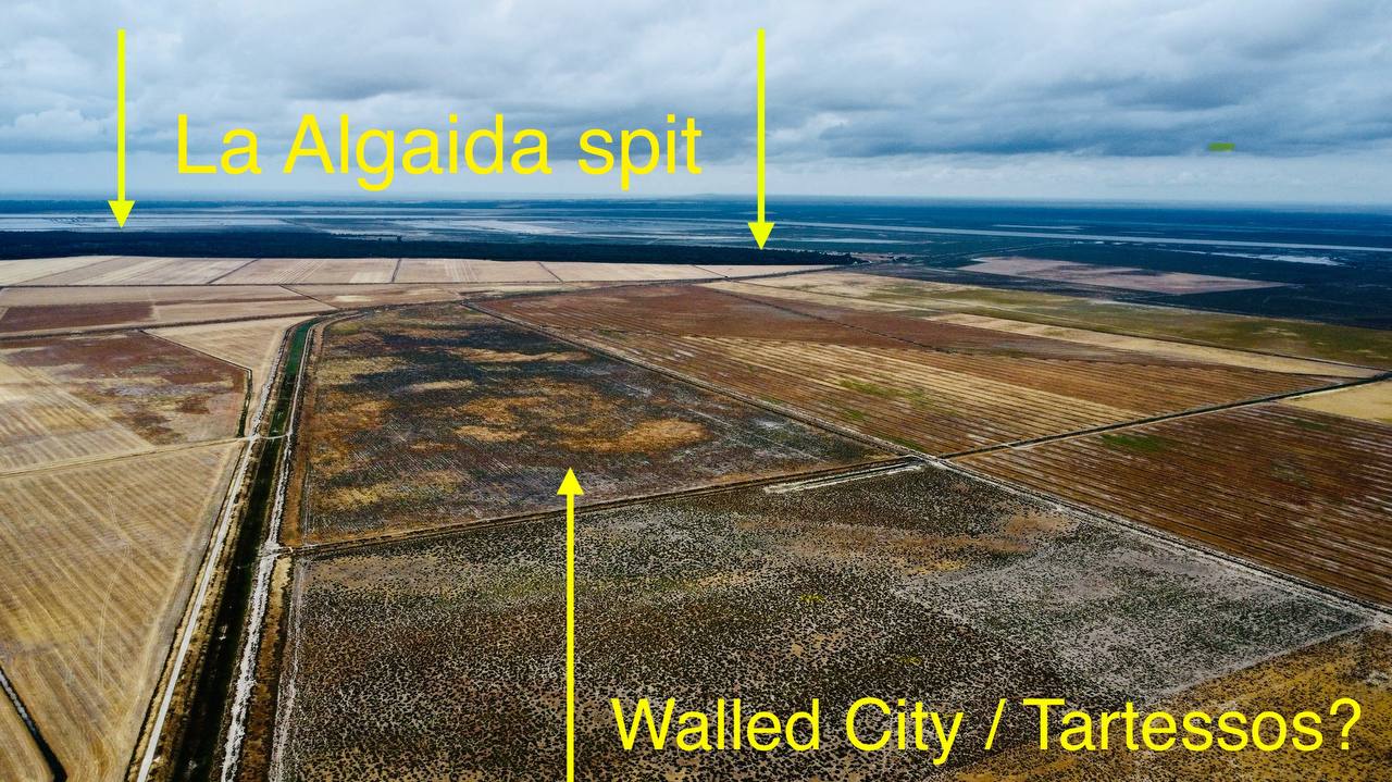
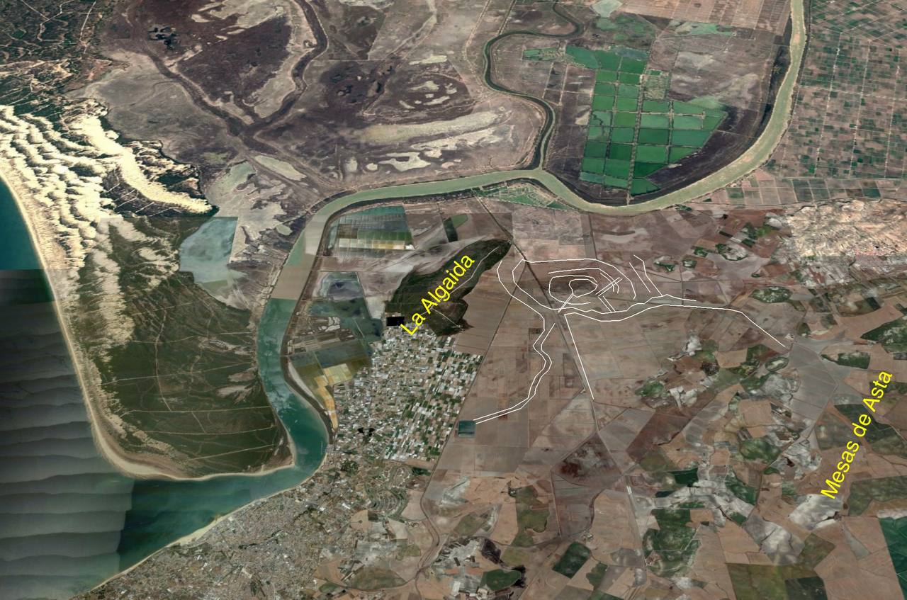
Proposed by: Villarías-Robles et al. | 2024
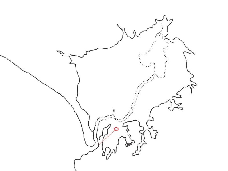
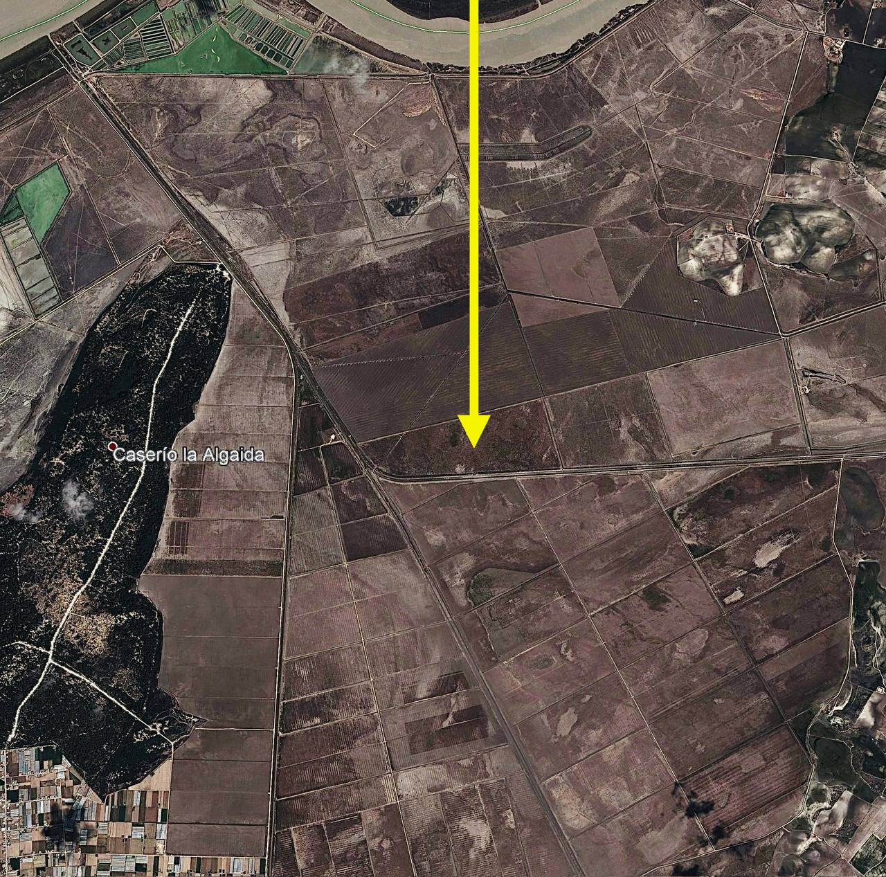
Currently favored: Proposes Tartessos on present-day La Algaida spit, which was an island in the first millennium BCE. Combines philological, archaeological, AND geomorphological evidence (Villarías-Robles et al., 2024).
The 1968 Jerez Symposium (organized by Maluquer de Motes) created a new "Jerez Paradigm":
"¡Déjate de Avieno y husmea el terreno!"
("Forget Avienus and pry into the ground!")
Critics of Avienus: Schmitt (1978), De Hoz (1989), González Ponce (1995), Marcotte (2000).
Arteaga & Roos (1992-1995): Marismas Project with 600+ survey sites. Addressed the "Lacus Ligustinus" problem (Arteaga and Roos, 1992; Arteaga, Schulz and Roos, 1995).
Key findings (Rodríguez-Ramírez et al., 1996, 2016):
"The Ligustinus was the paleo-estuary of the Baetis flumen... At present, it is a radically transformed landscape due to intensive sedimentation" (LiguSTAR Project, 2020).
Villarías-Robles et al. (2024) argue that geomorphological evidence now supports Avienus and that Tartessos likely stood on La Algaida spit.
Ancient Sources: Strabo and Avienus describe the Baetis with two mouths and an island between them.
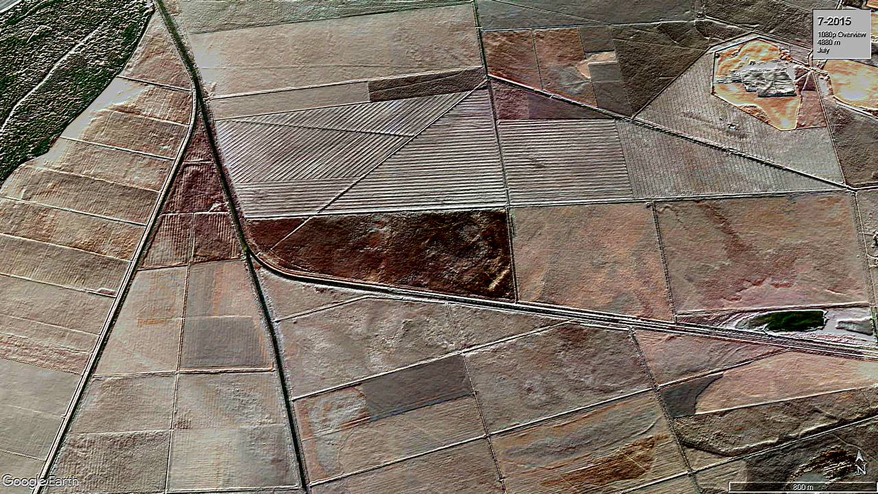
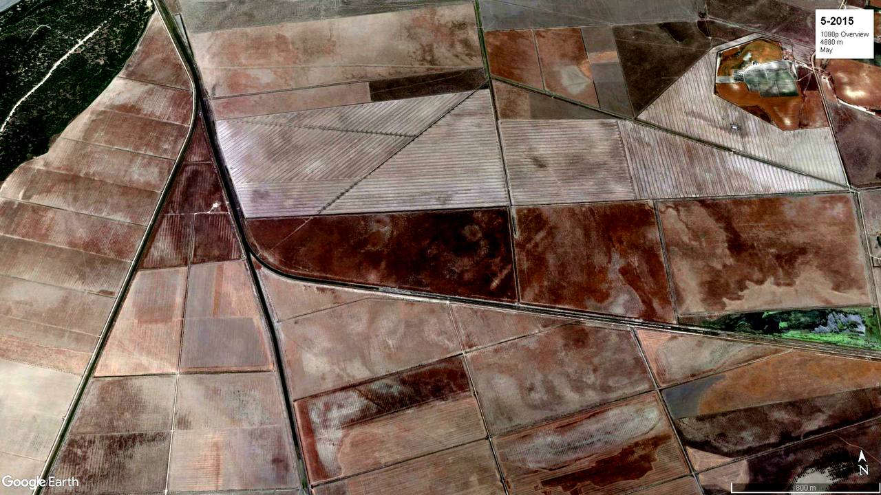
Geological Evidence: Multiple distributary channels, spit systems, finger delta formation—all support the "two mouths" description. The description is geologically consistent—not literary embellishment but observable geography.
The scholarly debate that began with Schulten (1922) and continues today is fundamentally structured by a single question: can we trust ancient literary sources to provide accurate geographic information about the Baetis estuary? Schulten believed they could—at least in general terms—and staked his archaeological reputation on testing this hypothesis at Cerro del Trigo. When the excavations failed to find Tartessian remains, this was not merely a negative result for one hypothesis; it was a crisis of confidence in the entire textual approach.
Gavala (1959) provided a new framework for thinking about this question. Rather than arguing about whether sources were "reliable" in the abstract, he demonstrated that the physical geography had changed so dramatically that understanding the sources required first reconstructing that geography geologically. His work reframed the debate from "are the sources true?" to "what did the sources actually see, given the geography of their time?" This was a crucial intervention because it showed that apparent contradictions between sources and archaeology might be resolvable through better geological data.
The Jerez Paradigm that emerged in 1968 represented a decisive turn against textual trust. Maluquer de Motes (1968) and his followers argued that scholarly effort should focus on archaeological evidence rather than textual interpretation. The critics of Avienus—Schmitt (1978), De Hoz (1989), González Ponce (1995), and Marcotte (2000)—developed sophisticated philological arguments for why the fourth-century CE poet could not be trusted as a source for archaic Tartessos. Their argument was not merely that Avienus might be wrong, but that his text belonged to a different literary and historical context that made historical reliability categorically impossible to assess.
However, this position was challenged by geoarchaeologists who argued that the question of reliability could not be settled purely through philological analysis. As Rodríguez-Ramírez and colleagues demonstrated through their systematic studies of the estuary (1996, 2016), the physical evidence for ancient geography was now sufficient to evaluate specific claims in ancient sources. When Avienus described "two mouths," this was no longer a matter of faith or literary criticism—it was a testable geographical claim. And the evidence, as the 2024 synthesis shows, supports him (Villarías-Robles et al., 2024).
A second major thread in the debate concerns methodology: what kinds of evidence should be privileged in reconstructing ancient geography? Schulten's approach was essentially archaeological—he wanted to find material remains that could confirm or refute textual claims. When Cerro del Trigo failed, this seemed to confirm the limitations of the textual approach.
Gavala (1959) introduced geology as a third methodological voice, arguing that without geological reconstruction, neither archaeology nor texts could be properly interpreted. His intervention showed that archaeology without geology was blind—the Cerro del Trigo excavation had been scientifically worthless because its premise (looking at the modern coastline to find an ancient city) was geologically absurd.
The geoarchaeological work of Arteaga, Schulz, and Roos (1992, 1995) represented a methodological synthesis—using archaeological and geological methods together to reconstruct the ancient landscape. Their 600+ survey sites provided the empirical foundation for evaluating all other claims. Similarly, the Rodríguez-Ramírez team's systematic drilling and sediment analysis (1996-2016) created a geological framework that could finally support confident interpretation of texts.
The 2024 synthesis by Villarías-Robles and colleagues represents the full flowering of this synthetic approach. They explicitly argue for combining "philological analysis of the relevant texts preserved from antiquity" with "the historical analysis of the archaeological record" and "the results of geomorphological, chronological, and paleoenvironmental studies" (2024, p. 3). This is methodology as dialogue, not as exclusive privilege.
Behind the methodological questions lay substantive disagreements about location. Schulten (1922) believed Tartessos was at Cerro del Trigo—this was specific enough to excavate. The failure of that excavation didn't settle the location question; it merely reset the terms of debate.
Gavala's (1959) geological evidence showed that many specific proposals were impossible, but it didn't uniquely determine a single correct location—it ruled things out rather than confirming them. The various alternatives that emerged in the mid-twentieth century—Mesas de Asta, Puerto de Santa María, Jerez, Huelva, Isla de León—each had their proponents and each their critics.
The critique of the Puerto de Santa María hypothesis is particularly instructive. Earlier scholars had proposed this location based on proximity to modern geography and interpretation of distance descriptions. But as Gavala (1959) showed, and as Arteaga, Schulz, and Roos (1995) confirmed with their sediment core studies, the geology simply doesn't permit this interpretation. The paleo-estuary didn't extend to Puerto de Santa María. This wasn't a matter of scholarly opinion—it was a geological fact.
The emergence of the La Algaida hypothesis in 2024 represents the first time since Schulten that a specific location has been supported by all three evidentiary strands: the textual descriptions (the island between two mouths), the archaeological evidence (settlements in the area), and the geological reconstruction (the spit was an island in the first millennium BCE). This convergence is what makes the 2024 synthesis distinctive (Villarías-Robles et al., 2024).
What does this century-long debate teach us about the nature of scholarly knowledge? Several lessons seem warranted.
First, that methodological pluralism is essential. No single approach—texts, archaeology, or geology alone—could resolve these questions. Each made contributions and each had limitations. The breakthrough came not from perfecting one method but from combining them.
Second, that negative results are productive. The failure of Cerro del Trigo, far from ending scholarly inquiry, forced a reconsideration of assumptions that ultimately led to deeper understanding. Similarly, the rejection of the Puerto de Santa María hypothesis as "geologically impossible" was a clarifying move that eliminated possibilities and focused attention on what was actually plausible.
Third, that the "reliability" of sources is the wrong question. Ancient sources are not either "reliable" or "unreliable" in the abstract. They make specific claims that can be tested against evidence. Avienus' description of "two mouths" turned out to be accurate—not because he was a generally reliable source, but because the geological evidence confirms the specific claim.
Fourth, that time and technology matter. Gavala in 1959 could not have done what Rodríguez-Ramírez accomplished in 2016—the drilling technology, sediment analysis techniques, and computational modeling simply didn't exist. The accumulation of geoarchaeological data over decades was necessary before synthesis became possible.
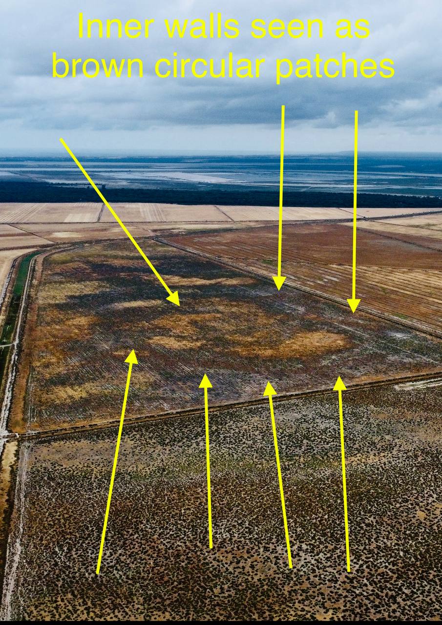
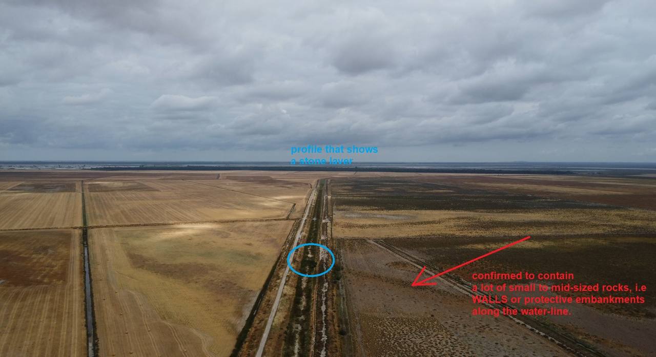
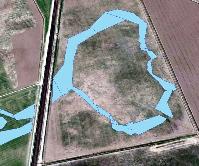
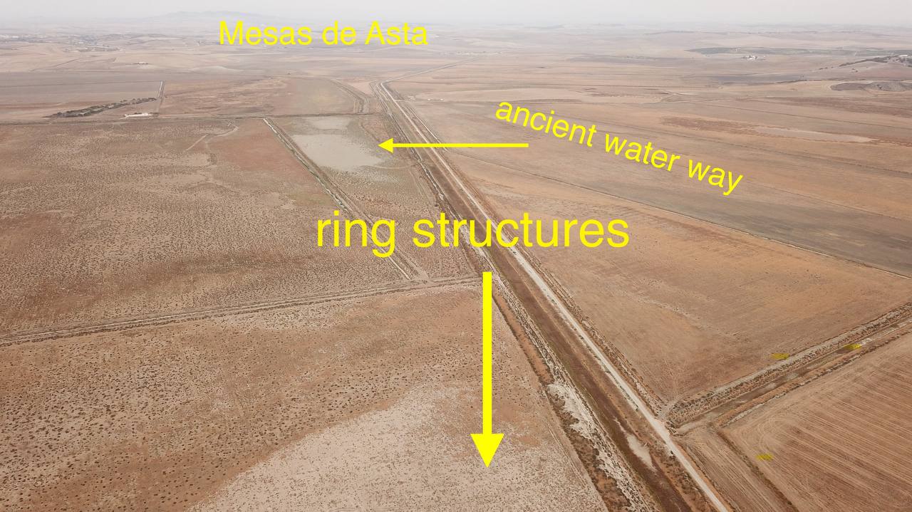
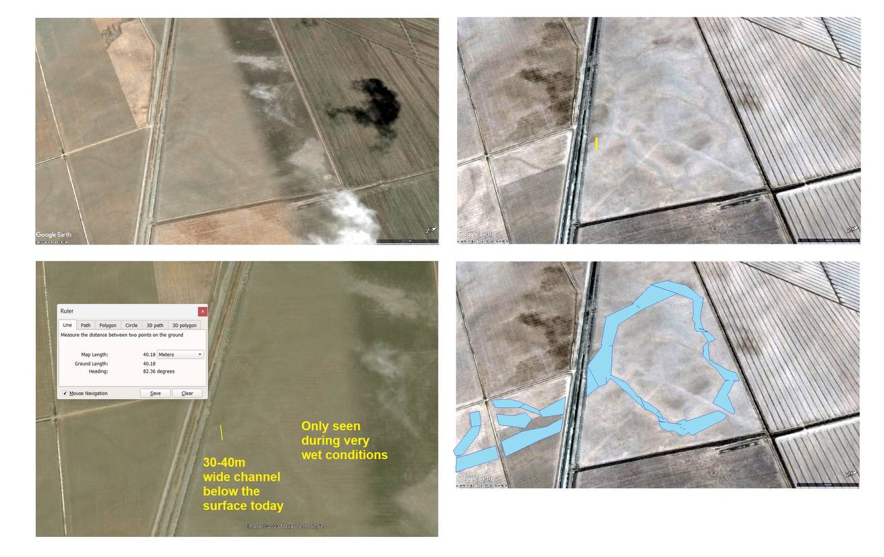
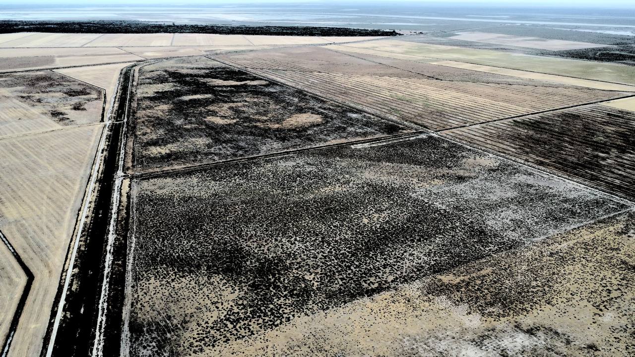
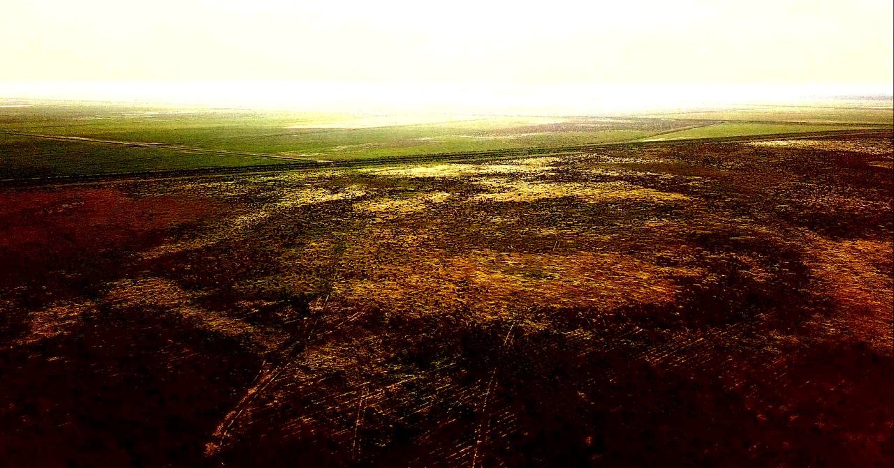
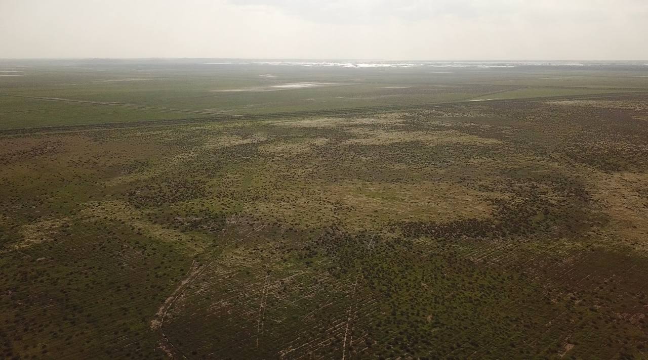
I noted the following interesting ring structures East and South-East of La Algaida in the direction of Mesas de Asta and Trebujena. We have clear remnants of an ancient waterway around these too. See Figure 5-10. (Bergman, 2016)
This comprehensive review of the scholarly debate reveals several key findings:
The century-long debate demonstrates the value of interdisciplinary approaches combining philology, archaeology, and especially geoarchaeology in understanding ancient landscapes that have undergone significant transformation.
Primary Ancient Sources:
Avienus, R.F. Ora Maritima (4th century CE). Translated by Murphy, J.P. (1977). Ora Maritima: Sea-Coast (Loeb Classical Library). Cambridge: Harvard University Press.
Pomponius Mela. De Chorographia (On the Description of the World), Book 3, section 5 (c. 43-45 CE).
Pausanias. Description of Greece (Periegesis tes Hellados), Book 6, chapter 19, section 3 (c. 150-175 CE).
Strabo. Geography, Book III (c. 7 BCE - 23 CE)
Foundational:
Arenas (1927). On the identification of Tartessos with Huelva.
Bonsor, G. (1928). Tartessos: Excavaciones practicadas en 1923 en el Cerro del Trigo. Memorias de la Junta Superior de Excavaciones y Antigüedades.
Chocomeli (1940). On the location of Tartessos at Mesas de Asta.
Fernández Amador de los Ríos (1925). On Tarfia as a location.
Gavala y Laborde, J. (1959). Estudios geológicos sobre la desembocadura del Guadalquivir.
Martín de la Torre (1940). On Asta Regia and Tartessos.
Pemán, C. (1941). On various locations including Jerez and Isla de León.
Schulten, A. (1922). Tartessos. Hamburg.
Schulten, A. (1955). Edition of Avienus' Ora Maritima.
Critics of Avienus:
De Hoz, J. (1989). Philological studies on Tartessos.
González Ponce, F.J. (1995). Periplographic tradition studies.
Marcotte, D. (2000). Artemidorus and Greek periplus tradition.
Schmitt, H.H. (1978). On the reliability of ancient sources.
Geoarchaeology:
Arteaga, O. and Roos, A.-M. (1992). El Proyecto Geoarqueológico de las Marismas del Guadalquivir. Anuario Arqueológico de Andalucía.
Arteaga, O., Schulz, H.D. and Roos, A.-M. (1995). El problema del Lacus Ligustinus. In Tartessos 25 años después.
LiguSTAR Project (2020). Archaeological Survey Techniques. Theoretical Roman Archaeology Journal.
Maluquer de Motes, J. (1968). V Symposium Internacional de Prehistoria Peninsular, Jerez de la Frontera.
Rodríguez-Ramírez Studies:
Rodríguez-Ramírez, A. (1998). PhD thesis on estuary geomorphology.
Rodríguez-Ramírez, A. et al. (1996). Evolución costera de la desembocadura del Guadalquivir. Geogaceta 20(5).
Rodríguez-Ramírez, A. et al. (2014). Atlantic Extreme Wave Events. ScienceDirect.
Rodríguez-Ramírez, A. et al. (2016). Geomorphological record of extreme wave events during Roman times in the Guadalquivir estuary. Geomorphology 261: 103-118. DOI: 10.1016/j.geomorph.2016.06.009.
Rodríguez-Ramírez, A. and Yáñez, C. (2008). Doñana coastal evolution studies.
Recent Synthesis:
Villarías-Robles, J.J.R., Rodríguez-Ramírez, A., López-Sáez, J.A., Celestino-Pérez, S. and León, Á. (2024). The location of Tartessos: a fresh case for the reliability of Avienus' Ora Maritima. Frontiers in Marine Science, 11. DOI: 10.3389/fmars.2024.1379920.